A new assessment tool for wetlands offers a practical way to view these critical habitats, quantify the services they provide, and identify high-value wetlands for restoration and enhancement.
“The Wetland Ecosystem Services Protocol (WESP) will shape wetland policy in B.C. by providing decision-makers with information about the natural ecosystem benefits provided by wetlands,” said Kyla Rushton, BCWF Wetland Assessment and Field Coordinator.
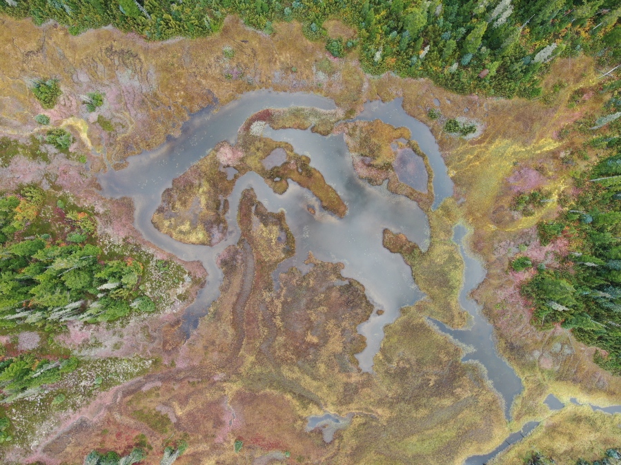
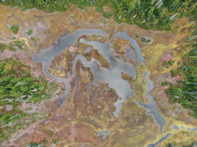
Wetlands can provide water purification services, water storage during flood events, natural breaks for wildfires, and habitat for fish and wildlife.
Wetlands were not always viewed so positively. Canadian wetlands have historically suffered loss or degradation due to destructive practices such as draining and diking, especially in populated areas. Development and climate change are also taking a toll on these vital ecosystems. The Wetland Ecosystem Services Protocol aims to change all that.
The tool being developed by the BCWF and its Watershed Team will build a catalogue of hundreds of wetlands, including all their important characteristics, to identify those that are most productive and those that are most in need of protection and restoration.
“The WESP tool is pivotal for improving decision-making around wetlands in B.C.,” said Rushton. “By quantifying some of the goods and services that wetlands offer, we will prioritize the conservation of high-value wetlands and provide a practical tool to evaluate wetland restoration projects in terms of the ecosystem goods and services they yield.”
“If your project goal is to protect waterbird habitat, two wetlands could be assessed, and the waterbird habitat function could be compared to determine which wetland should be prioritized to be protected from development,” she explained.

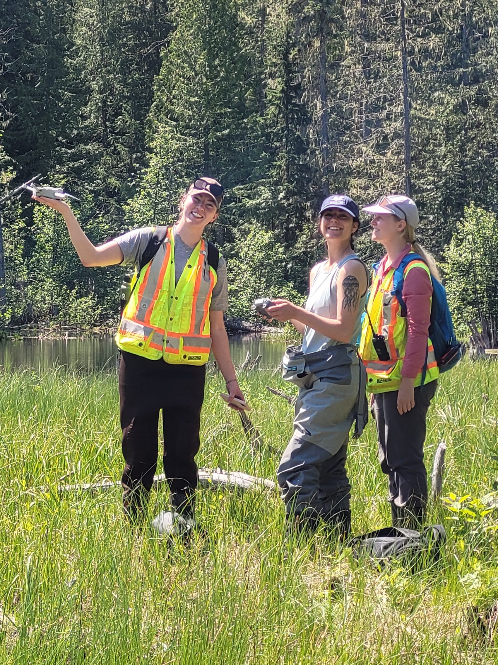
The BCWF’s Wetlands Workforce launched the WESP project in 2021, assessing wetlands across the province with field technicians from our partner organizations.
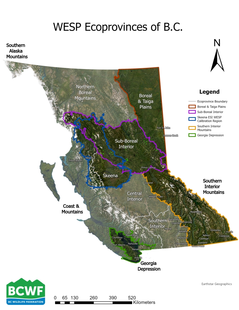
Crews were trained in wetland ecology and the use of drones for fieldwork. This kicked off the calibration process of the WESP model, which required information from more than 100 diverse wetlands in each defined region or “ecoprovince,” areas that have similar climate, geological history and physiography.
Rushton collaborated with the WESP model’s creator Paul Adamus to develop training materials and field protocols, to create sampling plans and to identify suitable wetlands to capture their diversity across regions. Between 30 and 60 wetlands were assessed in each of three B.C. regions in 2021.
Since then, Kyla has refined the calibration of the WESP resource and created user-friendly tools, such as the illustrative field guide on the BCWF’s Watershed Team website.
“We’ve been fortunate to partner with First Nations across the province for community engagement days and field training.” Kyla added. “Our work with non-government organizations like Nature Trust BC, Nature Conservancy of Canada, Ducks Unlimited Canada, and First Nations has been integral to the success of this project.”
“The financial and technical support from the provincial and federal government for the WESP resource and related fieldwork has been invaluable,” she said. “It’s encouraging to see the growing interest in a tool like the WESP model.”


Advantages and Applications
The WESP tool introduces an advanced approach to wetland decision-making in British Columbia, providing a standard measure to identify diverse benefits, such as ungulate habitat, water storage, and carbon sequestration. It offers a standardized method for assessing the ecological functions and benefits of the ecological services wetlands provide.
The tool allows for the consideration of multiple ecological functions using a standardized method, making it accessible even to those who are not experts in all 17 functions. WESP will also aid in rapid assessment of wetland function and the effectiveness of enhancement efforts.
In 2024, the BCWF is focused on continuing WESP data collection in the Thompson-Okanagan region and the Sub Boreal Interior ecoprovince.

This story first appeared in the May/June, 2024 issue of BC Outdoors Magazine in our member exclusive insert. Become a member today to get our news delivered directly to your mail box at www.bcwf.bc.ca/membership
This article was written by:
Jamie Long, Conservation Stewardship Communications Coordinator, B.C. Wildlife Federation
